Introduction
As the owner of Wood Creek Lake Dam, KYTC is required to maintain the dam for public safety. On October, 2018, personnel from the Division of Water inspected the above referenced structure. Based on their visual inspection of the dam, it is needed to monitor the seepage on the downstream slope for any significant increase in flow or change in color. The objectives for this project are as follows: Monitor water levels and flow color at the weir area of the toe of the downstream slope; Monitor changes in the lake elevation on the upstream side. This web site is developed to display the data collected and images from a camera to allow real time viewing. An alarm mechanism is configured to inform authorized personnel when any unusual events occur.

Wood Creek Lake Dam, I-75, Laurel County, KY (source: Google Maps)
|
|
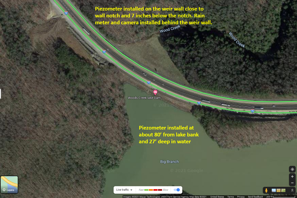
Bird's-eye view of location installed sensors, rain meter and camera at Wood Creek Lake Dam, I-75, Laurel County, KY (source: Google Maps)
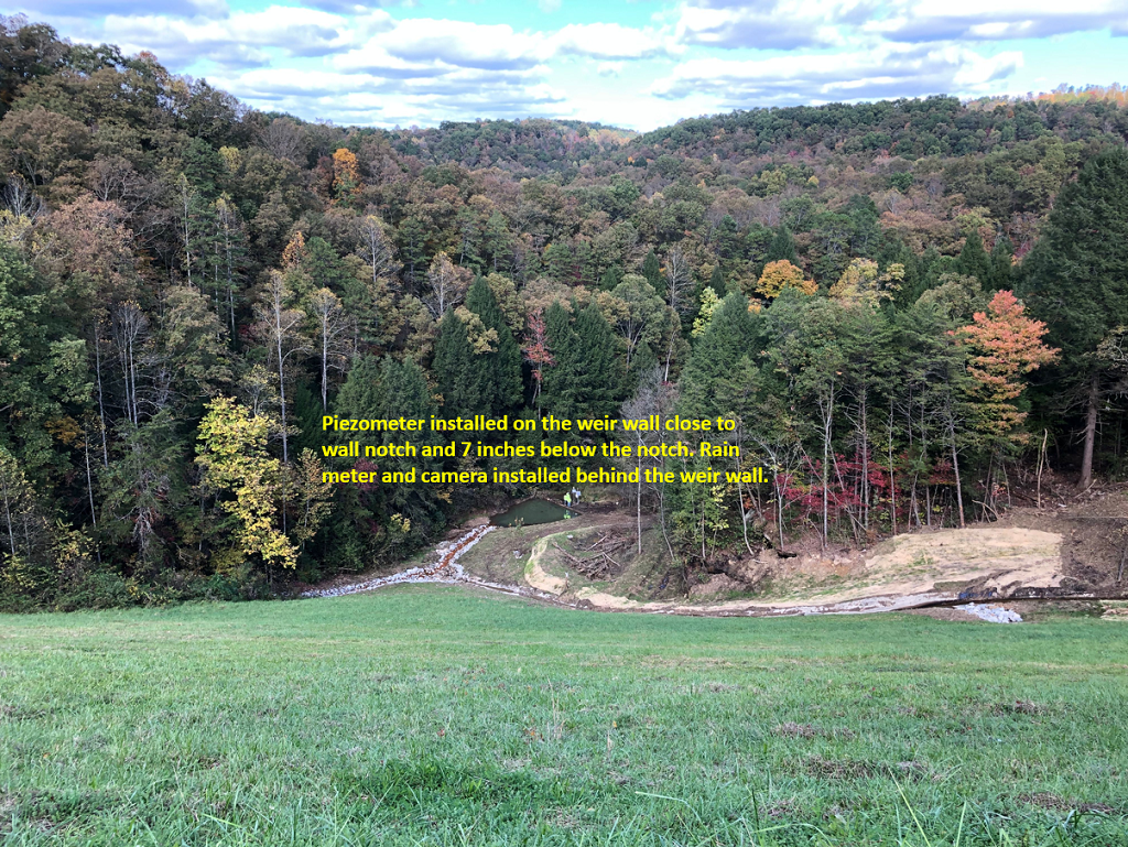
Bird's-eye view of location on weir side installed sensors, rain meter and camera at Wood Creek Lake Dam, I-75, Laurel County, KY
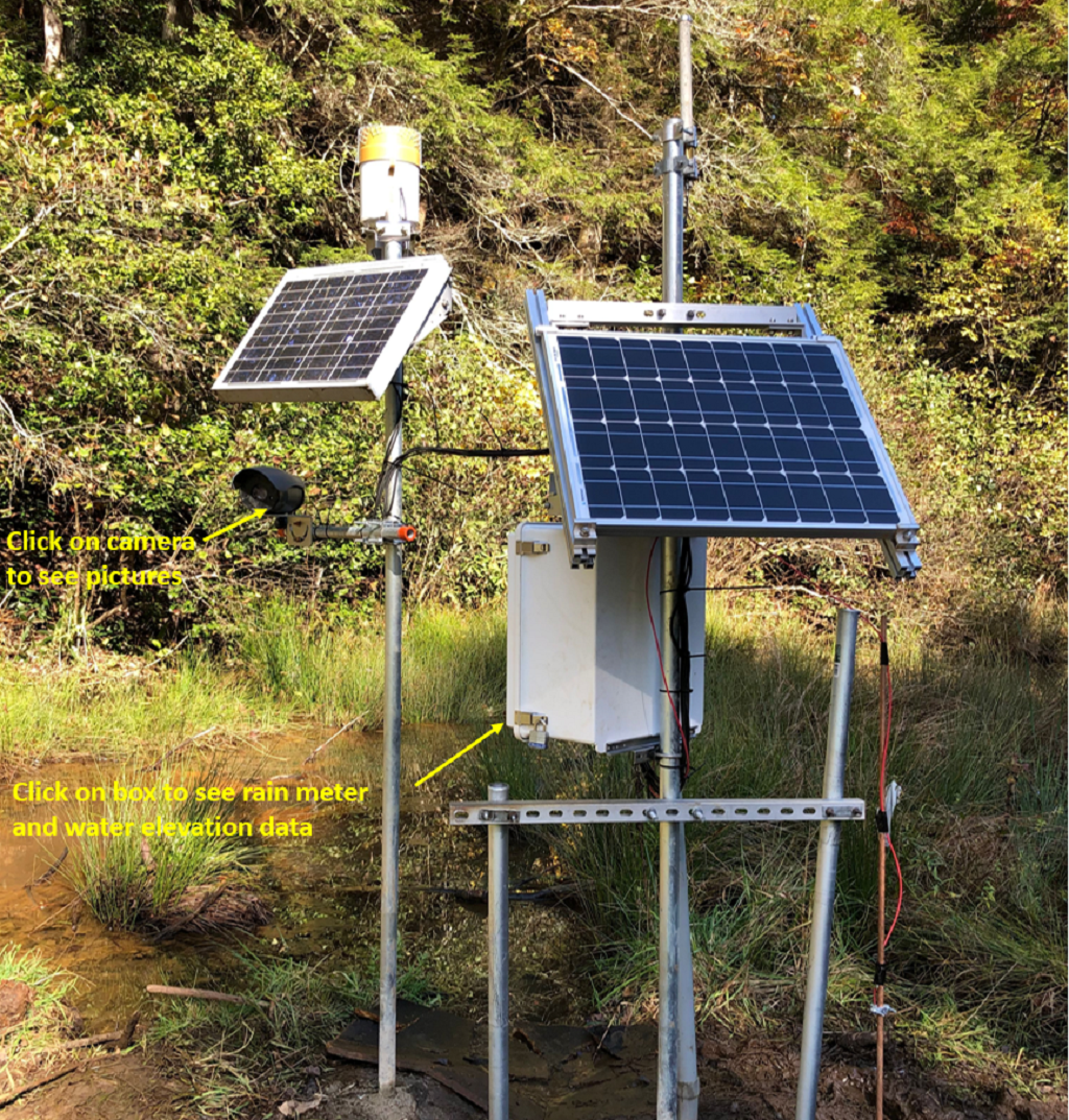
Weir side installation view
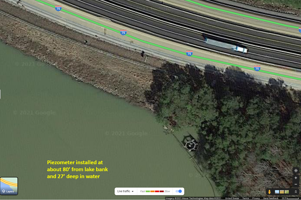
Bird's-eye view of location on lake side installed sensors at Wood Creek Lake Dam, I-75, Laurel County, KY (source: Google Maps)
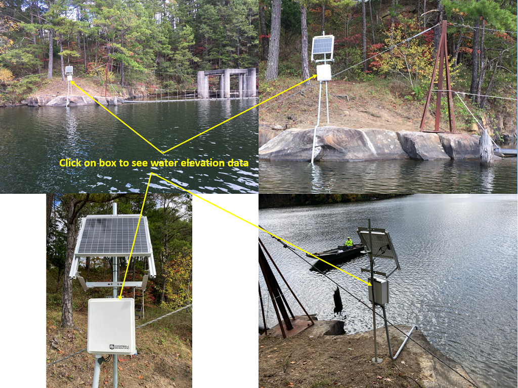
Lake side installation views
|